
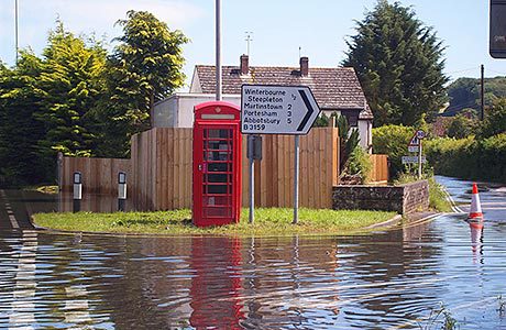
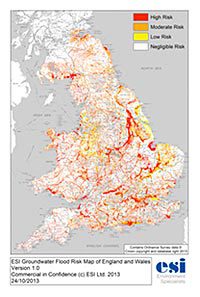
FOLLOWING the launch of its Groundwater Flood Risk map in October, water environment services provider ESI is offering Local Authorities a free licence to use the resource in relation to their local area.
The company’s MD Mark Fermor says groundwater flooding mechanisms and the prevalence of flooding caused by groundwater have previously been poorly defined. “By developing algorithms and using calibrated risk predictions to develop the model, we were able to identify that the areas at risk from groundwater flooding are considerably less than previously flagged by others – something that will have a major impact on those responsible for land management and development, such as Lead Local Flood Authorities.”
“As reliable data on groundwater flood events is sparse, we are offering to licence the Groundwater Flood Risk Map free of charge to Lead Local Flood Authorities in England and Wales that partner with us, join our new User Group, and commit to providing feedback and data to help us improve our national database and future editions of the map.”
ESI’s innovative Local Authority User Group will provide Lead Local Flood Authorities with access to vital information which will further help them to fulfil their responsibilities in respect of the Flood and Water Management Act 2010. The resource can be exploited by participating Authorities internally, and will also enable members of the public concerned about groundwater flooding to consult the map at their local Council offices.