


The Scottish Environment Protection Agency (SEPA) says it has advanced its flood risk management capabilities with the deployment of Scotland’s first public “near-shore” wave buoys for monitoring coastal flooding.
The wave buoys, deployed near Arbroath and Eyemouth, are part of a UK-wide WaveNet network coordinated by the Centre for Environment, Fisheries and Aquaculture Science (CEFAS), which provides critical information to better protect communities, infrastructure, and ecosystems.
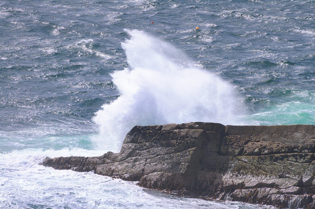
The buoys collect a wide range of data, including wave height, frequency, and direction. By analysing this data, SEPA aim to develop more accurate flood risk maps and improve the monitoring, forecasting and warning of coastal flooding events.
Steve McFarland, Lead Coastal Flooding Specialist at SEPA, said: “Our coastlines are on the front line of climate change impacts, and understanding the behaviour of waves is crucial for predicting and preparing for coastal flooding.
“The data from these wave buoys gives us invaluable insights into wave patterns and long-term trends, which are essential for creating robust flood risk models, protecting our coastal communities and helping them adapt to climate change.”
Enhancing flood forecasting and monitoring trends
The data collected by the wave buoys provides a more detailed and dynamic understanding of how coastal areas are affected by waves and storm surges. By integrating real-time wave data into existing modelling systems, SEPA can identify areas most at risk of flooding and generate more precise flood risk maps that reflect the current and future risks of coastal flooding.
This improved accuracy helps refine coastal flood forecasting: SEPA can use the data to better predict flooding from waves and provide timely warnings to communities, local authorities and emergency responders, enabling them to take pre-emptive actions to safeguard lives and property. Coastal flooding occurs at the shoreline, and so understanding wave conditions here is critical for providing an accurate prediction for communities.
Beyond immediate forecasting and risk mapping, the wave buoys also offer valuable data for monitoring long-term trends in wave behaviour. Understanding how wave patterns and intensity are changing over time is critical for assessing the impacts of climate change on Scotland’s coastlines and for guiding future actions to mitigate and adapt to coastal flood risk.
As sea levels rise due to climate change this understanding of wave conditions will become ever more important.
Tom Hull, Principle Scientist for WaveNet at CEFAS, said: “It is great to see Arbroath and Eyemouth join Cefas’ WaveNet network. Since 2002, WaveNet has been providing real-time wave data from a network of buoys across the UK.
“This data is used by the National Flood Forecasting Service and the Met Office to help improve wave and tidal surge models, as well as regional flood forecasters, local authorities, and scientists to better understand the risks and impacts of flooding on the marine environment and coastal communities. The observations made by these buoys will be invaluable to protect local people in the future.”
What the new data tells us
The new wave buoy data collected by SEPA since February 2024 has already provided invaluable new information about wave behaviour in the near-shore environment, helping build an understanding of which weather conditions will result in the largest waves and better warn for coastal flood events.
Measuring wave height continuously from deployment to the present enabled SEPA to identify increased wave heights during storm events in South-East Scotland during Spring 2024 and allowed for more accurate coastal flood forecasting and enhanced warning communications.
The data has also identified locations where wave heights may be more extreme and the risk of coastal flooding impacts therefore greater. For example, wave heights at Eyemouth have tended to be higher than at Arbroath due to its more exposed location to waves from the North Sea.
Steve McFarland added: “Continued monitoring of waves off the east coast of Scotland will allow us to track conditions during storm events over the next winter season and enable a better understanding of how waves close to the shore lead to coastal flooding during storms.
“Ultimately this will allow SEPA’s coastal flood warnings and flood mapping to better represent local conditions, both now and in the future, providing more accurate information upon which people and business in Scotland can adapt to a changing climate.”
You can view the data collected by the wave buoys here.