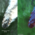
Earth observation images reveal extent of ferocious forest fires in Siberia
Stunning satellite images depict the recent gigantic infernos that devastated one of the coldest areas on the planet. Last month fires burning across Siberia...
Survey identifies significant micro plastic pollution on summit of Snowdon
Geoscience technology firm CGG has conducted a microplastics pollution survey as part of a scoping study into whether it would be possible to create...
Environmental hazard monitoring expert announces 2021 webinar series for dust, noise, vibration and asbestos...
Global occupational health and workplace hazard monitoring expert Casella has announced its schedule of webinars for 2021. The line-up of free-to-attend, virtually accessible webinars...
Perseverance touches down on the red planet
NASA’s Perseverance rover, launched in July 2020, landed on Mars on 18 February. The Perseverance's mission involves exploration of the red planet's Jezero crater....
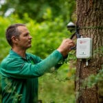
IoT project will assess impact of climate change on forests, and inform UK policymaking
A trial is underway in forests in Surrey and Northumberland to assess the potential for Internet of Things (IoT) technology to monitor tree growth...
Gas sensor technology heads to Mars on board NASA’s Perseverance rover
An international collaboration is taking technology from gas measurement expert Vaisala and the Finnish Meteorological Institute (FMI) to Mars onboard NASA’s Mars 2020 Perseverance...
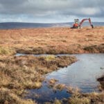
Peak District National Park commissions ultra-high resolution aerial maps
The Peak District National Park Authority has commissioned a brand new ultra-high resolution aerial survey from aerial mapping firm Bluesky to map land cover...
Listen up: Limited time offer on noise monitoring equipment
According to estimates from the Health and Safety Executive (HSE), 21,000 workers suffered with work related hearing problems between 2017 and 2019, with industrial...
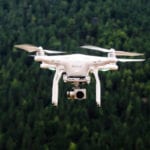
Researcher creates drone system to give early warning on natural disasters and act as...
A researcher at Queen’s University Belfast has invented a low cost telecommunication system using drones which provides early warning on natural disasters and acts...
Weather monitoring in extreme conditions
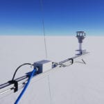
A VENTUS X ultrasonic wind sensor has been deployed by researchers at the Summit Station on the Greenland Ice Sheet in the Arctic, 10,000...
Aerial map reveals Islington’s tree cover, and assists study into benefits of trees in...
Treeconomics, a specialist in the use of trees to improve urban spaces, is taking advantage of a nationwide digital record of over 300 million...
Sponsored content: Monitoring airflow in road tunnels
Article provided by CODEL International Ltd. Find out more at codel.co.uk
In most road tunnels there are ventilation systems installed of which there are three...
High resolution ground vibration monitoring system satisfies residential and local authority requirements
Bedford-based AcSoft Sound & Vibration (www.acsoft.co.uk) has recently supplied two Menhir (Modular Enhanced Intelligent Recorder) ground vibration monitors from Semex Engcon to long-standing customer,...
Radon maps don’t show radon levels in a specific building
Indoor radon inhalation kills more people each year (in Ireland) than carbon monoxide poisoning, fires and road accidents combined. Radon testing firm Radonova makes...
Government funding for project to supply Africa with electricity from waste
An Earth Observation Innovation team from the University of Leicester is collaborating with UK energy-from-waste-biomass firm PyroGenesys and a number of UK and international...
Noise monitoring equipment supplied for London demolition project
Svantek, a manufacturer of high performance noise and vibration instrumentation for environmental and occupational health monitoring applications, has recently supplied four SV 307 noise...
Geo-data specialist supports entire English coastal monitoring network
The recent award of a three-year maintenance contract for the hydrodynamic element of the Anglian Coastal Monitoring programme means that geo-data specialist Fugro now...
Landmark flight time recorded for hydrogen-powered UAV
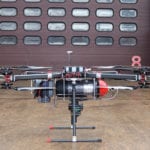
A project to develop a hydrogen fuel cell powered multi-rotor unmanned aerial vehicle (UAV), has beaten its original test flight target of 60 minutes...
Doppler resonance LIDAR promises advances in sensitivity and real-time performance for atmospheric research
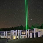
Sensitive enough to detect laser beam reflections from single atoms 100 km away even in broad daylight
Atmospheric research uses pulsed laser beams to measure...
Instruments offer quick and simple analysis of metal content
Responding to customer demand from a wide variety of sectors, Ashtead Technology has added additional Niton XL3t GOLDD+ XRF Analysers to its rental fleet...


