

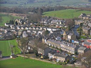
Detailed terrain maps created from aerial surveys using lasers are being used to help improve flood prevention and management across Yorkshire.
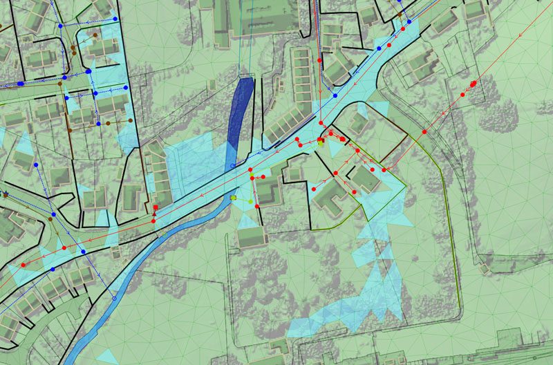
Mott MacDonald Bentley (MMB) recently commissioned aerial mapping company Bluesky to capture highly detailed 3D maps in order to model overland flood routes. Working on behalf of Yorkshire Water, as part of the current £1 billion asset management framework, MMB is working on studies to investigate catchment flooding from the public sewer network. The Bluesky LiDAR data is being used to create accurate models of the terrain and ground features in relation to the sewer network. These models help MMB assess predicted flooding, understand the potential impact of flooding and replicate reported flood events in order to develop holistic solutions.
“Using the Bluesky LiDAR data we can obtain a more accurate understanding of overland flood routes, and have a better understanding of structures that might impact on the movement of flood water and properties that might be impacted by a flood event,” commented Danielle Carr, Senior Hydraulic Modeller at MMB. “This enables us to design robust solutions to prevent flooding and therefore protect properties, their residents, and the local environment.”
MMB commissioned Bluesky to capture high resolution, 4 points per metre (ppm), LiDAR for two catchment areas in Yorkshire. The raw point cloud data was then used to create 50 cm Digital Terrain and Digital Surface Models (DTM and DSM). MMB imported the Bluesky models into the modelling software to create a surface mesh of the terrain and review surface structures that would alter flood routes, such as buildings, walls and watercourses. The simulations, which include the full sewer network and the surface mesh, help MMB assess overland flood routing, and therefore understand which properties are likely to be affected, and accurately replicate any reported flooding.
MMB is a joint venture between multi-disciplinary consultancy Mott MacDonald and leading civil engineering and construction company JN Bentley. In 2013, MMB was awarded a five-year framework extension by Yorkshire Water. As a result the joint venture will help deliver £1 billion of planned investment throughout the asset management period (AMP6) which runs until 2020.


