Climate projections for the UK suggest that rainfall will increase in winter and decrease in summer, and that individual rainfall events may increase in intensity, especially in winter. This paradigm predicates an increased risk of flooding.
Emphasising the urgent need for action on flood risk, Environment Agency chairwoman Emma Howard Boyd has said that on current trends, global temperature could rise between 2ºC and 4ºC by 2100 and some communities may even need to move because of the risk of floods. Launching a consultation on the agency’s flood strategy, she said: “We can’t win a war against water by building away climate change with infinitely high flood defences.” In response, Mike Childs, head of science at Friends of the Earth, said: “Smarter adaptation and resilience building – including natural flood management measures like tree-planting – is undeniably important but the focus must first and foremost be on slashing emissions so that we can avoid the worst consequences of climate chaos in the first place.”
Historically, floodplains have been exploited for agricultural and urban development, which has increased the exposure of people, property and other infrastructure to floods. Flood risk management therefore focused on measures to protect communities and industry in affected areas. However, flood risk is now addressed on a wider catchment scale so that initiatives in one part of a catchment do not have negative effects further downstream. This catchment-based approach is embodied within the EU Floods Directive 2007/60/EC, and in recent years, those responsible for flood management have increasingly looked for solutions that employ techniques which work with natural hydrological and morphological processes, features and characteristics to manage the sources and pathways of flood waters. These techniques are known as natural flood management (NFM) and include the restoration, enhancement and alteration of natural features but exclude traditional flood defence engineering that effectively disrupts these natural processes.
NFM seeks to create efficiency and sustainability in the way the environment is managed by recognising that when land and water are managed together at the catchment scale it is possible to generate whole catchment improvements with multiple benefits.
Almost all NFM techniques aim to slow the flow of water and whilst closely connected, can be broadly categorised as infiltration, conveyance and storage.
Infiltration
Land use changes such as set-aside, switching arable to grassland or restricted hillside cropping, can improve infiltration and increase water retention. In addition, direct drilling, ‘no-till’ techniques and cross slope ploughing can have a similar effect. These land use techniques are designed to reduce the soil compaction which increases run-off. Livestock practices such as lower stocking rates and shorter grazing seasons can also help. Field drainage can be designed to increase storage and reduce impermeability, which is also aided by low ground pressure vehicles. The planting of shrubs and trees also helps infiltration and retention by generating a demand for soil moisture, so that soils have a greater capacity to absorb water. Plants also help to bind soil particles, resulting in less erosion – the cause of fertility loss and sedimentation in streams and rivers.
Conveyance
Ditches and moorland grips can be blocked to reduce conveyance, and river profiles can be restored to slow the flow. In the past, peats and bogs have been drained to increase cropping areas, but this damages peatlands and reduces their capacity to retain water and store carbon. The restoration of peatland therefore relies on techniques to restore moisture levels. Pumping and drainage regimes can be modified, and landowners can create strategically positioned hedges, shelter belts and buffer strips to reduce water conveyance.
Storage
Rivers can be reconnected with restored floodplains and river re-profiling, leaky dams, channel works and riparian improvements can all contribute to improved storage capability. In urban areas permeable surfaces and underground storage can be implemented, and washlands and retention ponds can be created in all areas. As mentioned above, the re-wetting of peatland and bogs helps to increase storage capacity.
Many of the effects of NFM might be achieved with the re-introduction of beavers, which build dams that reduce peak flows, create pools and saturate soil above their dams. The dams also help to remove pollutants such as phosphates. Beavers do not eat fish, instead preferring aquatic plants, grasses and shrubs during the summer and woody plants in winter. Beavers are now being introduced in a number of areas in trials to determine their value in the implementation of NFM. One of the key benefits offered by beavers is their ability to quickly repair and rebuild dams that are damaged during extreme weather. However, whilst the potential benefits of beavers are well known, several groups have expressed concern with the prospect of their widespread introduction. For example, farmers and landowners may find increased areas of waterlogged land due to blocked drainage channels. In addition, dams present a threat to migratory fish such as salmon and sea trout.
Beavers are native to the UK and used to be widespread, but they were hunted to extinction during the 16th century. However, other non-native species such as signal crayfish can have a detrimental effect on flood protection because they burrow into river banks causing erosion, bank collapse and sediment pollution. Signal crayfish are bigger, grow faster, reproduce more quickly and tolerate a wider range of conditions than the native white-clawed crayfish. Signal crayfish are also voracious predators, feeding on fish, frogs, invertebrates and plants, and as such can create significant negative ecological effects.
NFM benefits
NFM provides protection for smaller flood events, reduces peak flooding and delays the arrival of the flood peak downstream. However, it does not mitigate the risk from extreme flood events. Effective flood management strategy therefore tends to combine NFM with hard engineering measures. Nevertheless, NFM generally provides a broader spectrum of other benefits.
The creation of new woodlands and wetlands produces biodiverse habitats with greater flood storage capacity. They also enable more species to move between habitats. NFM measures that reduce soil erosion, run-off and sedimentation also help to improve water quality and thereby also improve habitats. In particular, these measures lower nutrient and sediment loading lower in the catchment; two issues which can have dramatic effects on water quality and amenity.
Land use and land management measures help to reduce the loss of topsoil and nutrients. This improves agricultural productivity and lowers the cost of fertilizers. Furthermore, a wide range of grants are available for NFM measures, such as the creation of green spaces and floodplains, to make them more financially attractive to farmers and landowners.
Many NFM measures help in the fight against climate change. For example, wetlands and woodlands are effective at storing carbon and removing carbon dioxide from the atmosphere. Measures that reduce surface run off and soil erosion, such as contour cultivation, can also reduce carbon loss from soil.
Monitoring NFM
Given the wide range of potential NFM benefits outlined above, the number and type of parameters to be monitored are likely to be equally diverse. Baseline data is essential if the impacts of implemented measures are to be assessed, but this may not always be deliverable. For example, it may only be possible to collect one season of data prior to a five year project. However, it may be possible to secure baseline data from other parties. In all instances data should of course be accurate, reliable, relevant and comparable.
…it may only be possible to collect one season of data prior to a five-year project. However, it maybe be possible to secure baseline data from other parties.
Monitoring data should be used to inform the design of NFMs. For example, a detailed understanding of the ecology, geomorphology, hydrology and meteorology of the entire catchment will help to ensure that the correct measures are chosen. These measures should be selected in partnership with all stakeholders, and ongoing monitoring should provide visibility of the effects of NFM measures. Typically stakeholders will include funders, project partners, local communities, landowners, regulators and local authorities.
Since NFM measures are designed to benefit an entire catchment, it is important that monitoring is also catchment-wide. However, this is likely to be a large area so there will be financial implications, particularly for work that is labour-intensive. Consequently, it will be necessary to prioritise monitoring tasks and to deploy remote, automatic technology wherever it is cost-effective.
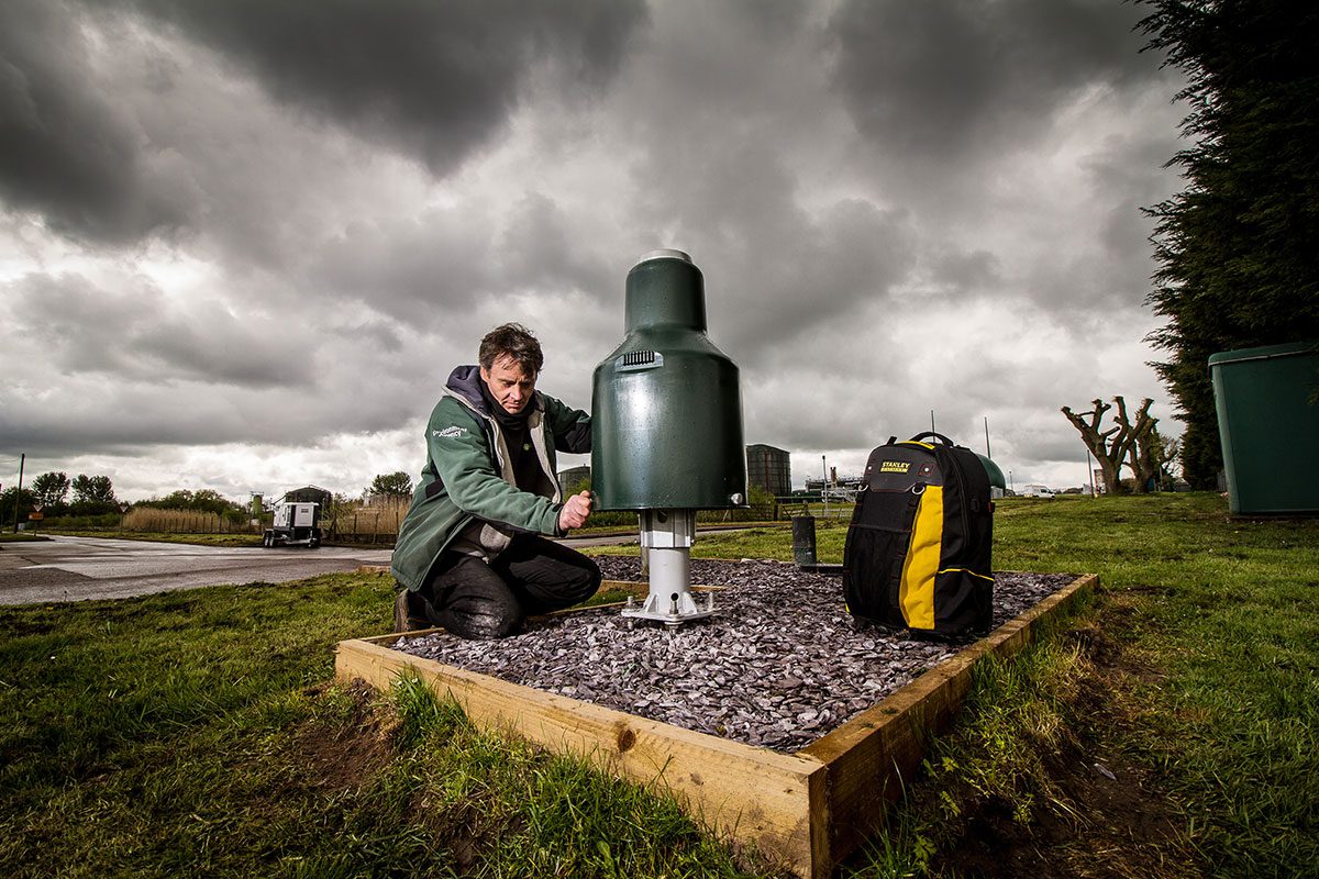
Clearly, key parameters such as rainfall, groundwater level, river level and surface water quality should be monitored continuously in multiple locations if the benefits of NFM are to be measured effectively. It is fortunate therefore that all of these measurements can be taken continuously 24/7 by instruments that can be left to monitor in remote locations without a requirement for frequent visits to calibrate, service or change power supplies. As a business OTT Hydromet has been focused on the development of this capability for many years, developing sensors that are sufficiently rugged to operate in potentially aggressive environments, data loggers with enormous capacity but with very low power requirement, and advanced communications technologies so that field data can be instantly viewed by all stakeholders.
Recent developments in data management have led to the development of web-enabled data management solutions such as Hydromet Cloud, which, via a website and App, delivers the backend infrastructure to receive, decode, process, display and store measurement data from nearly any remote hydromet monitoring station or sensor via a cloud-based data hosting platform. As a consequence, alarms can be raised automatically, which facilitates integration with hard engineering flood control measures. Hydromet Cloud also provides access to both current and historic measurement data, enabling stakeholders to view the status of an entire catchment on one screen.

Image credit: Barrie Scholes, the Environment Agency
Holme Fen: A monitoring lesson from the 1850s
Surrounded by prime agricultural land to the south of Peterborough, the fens originally contained many shallow lakes, of which Whittlesey Mere was the largest, covering around 750 hectares in the summer and around twice that in the winter. Fed by the River Nene, the mere was very shallow and was the last of the ‘great meres’ to be drained and thereby converted to cultivatable land.
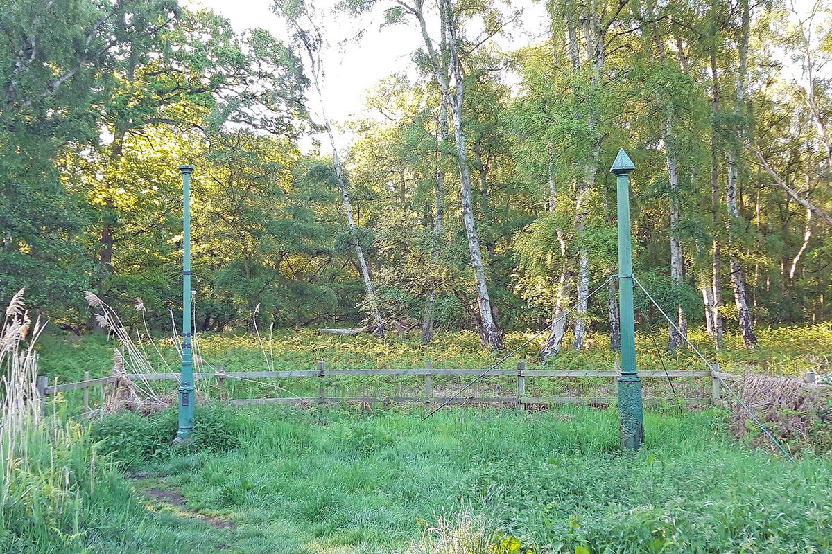
Led by William Wells, a group of local landowners funded and arranged the drainage project, which involved the development of a newly invented steam powered centrifugal pump which was capable of raising over 100 tons of water per minute by 2 or 3 feet. A new main drain was constructed to take water to the Wash. Conscious of the likely shrinking effect of drainage on the peaty soil, Wells instigated the burial of a measurement post, which was anchored in the Oxford Clay bedrock and cut off at the soil surface. In 1851 the original timber post was replaced by a cast iron column which is believed to have come from the Crystal Palace in London.
By installing a measurement post, Wells demonstrated remarkable foresight. As the drainage proceeded, the ground level sank considerably; by 1.44 metres in the first 12 years, and by about 3 metres in the first 40 years. Today, around 4 metres of the post is showing above ground, recording the ground subsidence since 1852. The ground level at Holme Post is now 2.75 metres below sea level – the lowest land point in Great Britain.
Several complications have arisen as a result of the drainage. Firstly, there has been a huge impact in local ecology and biodiversity with the loss of a large area of wetland. Also, as the ground level subsided it became less sustainable to pump water up into the main drain.

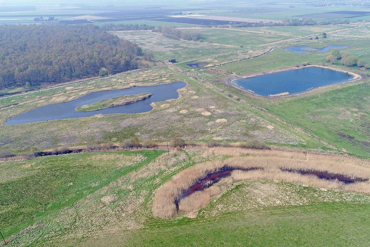
Holme Fen is now a National Nature Reserve, managed by Natural England, as is the nearby Woodwalton Fen. They are both part of the Great Fen Project, an exciting habitat restoration project, involving several partners, including the local Wildlife Trust, Natural England and the Environment Agency. At Woodwalton, the more frequent extreme weather events that occur because of climate change result in flooding that spills into the reserve. In the past, this was a good example of NFM as the reserve provided a buffer for excess floodwater. However, Great Fen Monitoring and Research Officer Henry Stanier says: “Floodwater increasingly contains high levels of nutrients and silt which can harm the reserve’s ecology, so a holistic, future-proof strategy for the area is necessary.”
Applauding the farsightedness of William Wells, Henry says: “As a conservationist I am often called in to set up monitoring after ecological recovery has begun, rather than during or even before harm has taken place. At the Wildlife Trust, we are therefore following the example provided by Wells, and have a network of monitoring wells in place so that we can monitor the effects of any future changes in land management.
“For example, we are setting up a grant funded project to identify the most appropriate crops for this area; now and in the future, and we are working with OTT to develop a monitoring strategy that will integrate well monitoring with the measurement of nutrients such as phosphate and nitrate in surface waters.”
Monitoring provides an opportunity to measure the effects of initiatives and mitigation measures. It also enables the identification of trends so that timely measures can be undertaken before challenges become problems, and problems become catastrophes.
Monitoring is an essential component of NFM, helping to define appropriate measures, measure their success, keep stakeholders informed, identify mistakes, raise alarms when necessary, inform adaptive management and help guide future research.


