West Oxfordshire District Council (WODC) in the UK recently refused a planning application on the grounds of flood risk. The proposed development included the construction of just a single dwelling within the village of Standlake. However, local campaigners were able to argue against the proposal with the benefit of groundwater level data provided by a continuous level logger that had been installed in the garden of an adjacent property. Instrumentation firm OTT HydroMet writes.
In this case, the developer took occasional manual measurements that were found to be of limited value in comparison with continuous readings from a professional borehole logger from OTT HydroMet.
“The groundwater level data was critically important to our case,” explains local campaigner Paula Gaffney. “The village of Standlake is heavily affected by flooding, so this is a major consideration in any proposed new development, but without evidence, it is difficult to draw reliable conclusions.
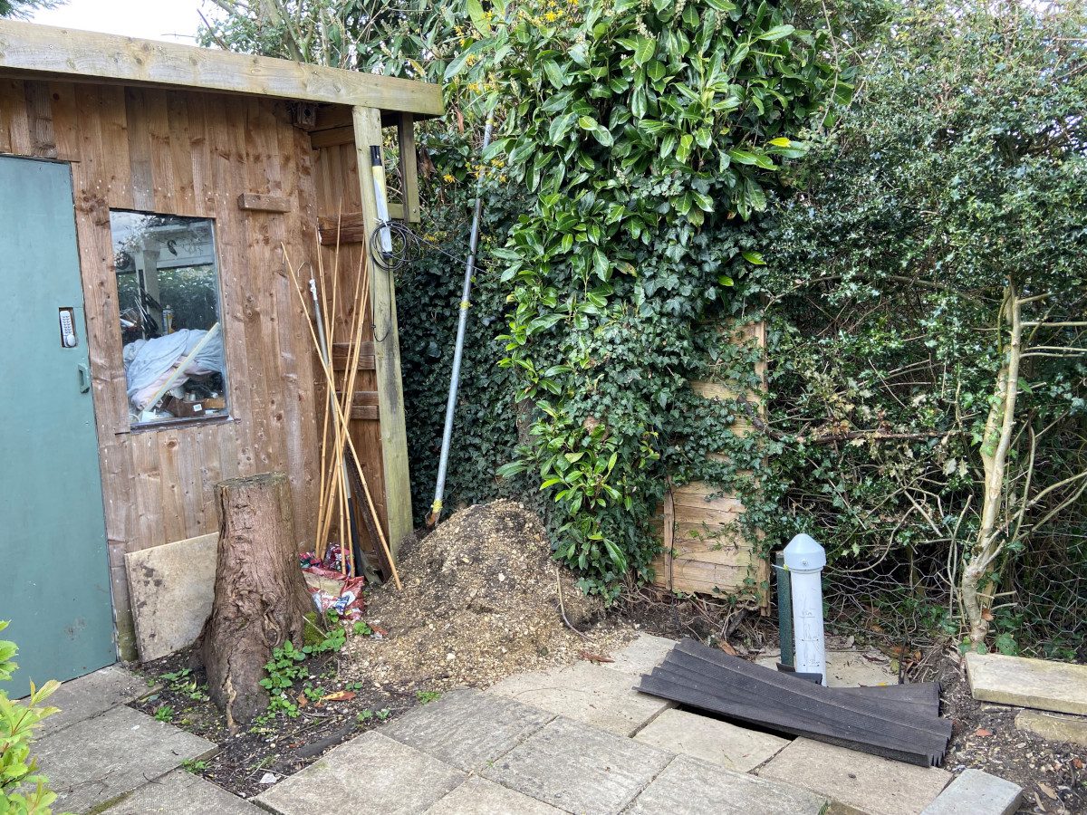
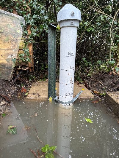
“For this reason, we dug two boreholes adjacent to the proposed development site and rented an OTT ecoLog 1000 water level logger from OTT HydroMet to take measurements automatically every 15 minutes, 24/7.
“This generated a continuous data stream that provided a wealth of information on local groundwater conditions, particularly when combined with rainfall data from the nearby Brize Norton meteorological station.
“Perhaps the most striking conclusion was the stark contrast between our continuous data stream and the developer’s occasional manual observations from the borehole that they had constructed in the middle of the proposed development site. In particular, the WODC Lowlands Planning Sub Committee were interested to note that the applicant’s water level observations did not coincide with any of the heavy rainfall events that took place.”
Standlake is located alongside the River Windrush, close to the point where it joins the River Thames. Village residents have become accustomed to regular flooding, which is mostly derived from rising groundwater. Drainage pipe ingress is also a problem and Thames Water frequently supplies tankers to help alleviate flood damage. However, Standlake is by no means unique with its flood-related challenges and since their success in fighting the development application, the campaigners have been contacted by other villages seeking help and advice on ways to handle planning applications in flood zones.
“Our recommendation is always to gather reliable data,” says Paula Gaffney. “The installation of the monitoring system was much easier than we initially anticipated. Digging the boreholes was probably the hardest part! The telephone support from OTT HydroMet was excellent – helping us to set the monitor to record the distance from ground surface to the water, which was occasionally near to zero, after heavy rain.
“Online access to the data via the Hydromet Cloud web portal provided by OTT Hydromet was also very useful. The ability to access real-time data in the cloud gave full and transparent data access to the WODC planning and drainage officers so that they could see the rapid rise of high water table events and the slow infiltration rate as ground water levels fell over several days.”
The OTT ecoLog 1000 comprises a data logger connected by cable to a stainless-steel probe containing a very stable ceramic pressure cell. The datalogger stores measurements locally, but also transmits encrypted data to a website that can be easily accessed by all stakeholders, providing transparent access to trustworthy data.
Explaining the importance of data reliability, Paula says: “The installation of the ecoLog was simple and intuitive, but we were keen for OTT’s support engineers to check the configuration, so that it could be relied upon as evidence. This contrasted starkly with the applicant’s manually derived measurements, which were obviously selective and, in some cases, could be erroneous.”
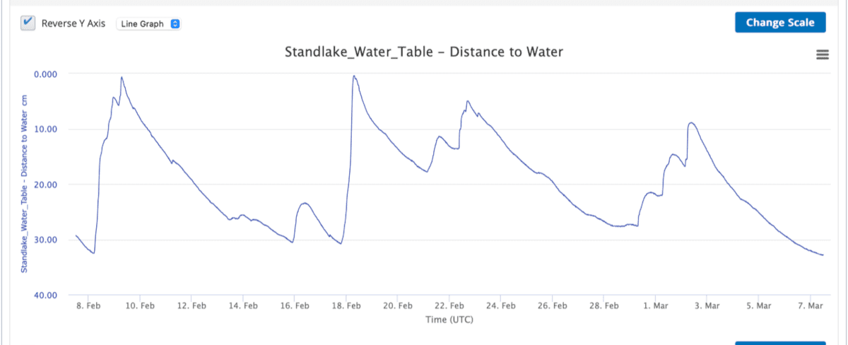
Oxfordshire County Council’s drainage engineer visited the site and determined that the logger’s data demonstrated the site to be outside the tolerance required for effective soakaways. He also noted the absence of readings by the applicant during or following flood events and suggested that the applicant should also operate an automatic borehole logger.
Summarising, Paula says: “We were very impressed with the diligence of the WODC Lowlands Planning Sub Committee, and obviously delighted that the evidence we provided empowered them to determine that the proposed development would result in unacceptable flood risk. In fact, one of the councillors remarked that this was the first time an application had been refused on the grounds of flood risk.”
Typical users of the OTT ecoLog 1000 include government agencies, flood managers, developers, local communities, highway managers, rail network operators, water companies and water resource managers, as well as consultants, academics and environmental researchers. However, OTT HydroMet’s Dr Liam Goodes says: “Climate change is increasing the frequency and severity of extreme weather, so it seems likely that flood risk is set to become a greater issue in planning and development.
“Obviously, Planning decisions have to be informed by reliable facts, underpinned by accurate data. Groundwater levels can change quickly, so the OTT ecoLog offers all stakeholders, including councils, developers and local communities, an opportunity to create reliable evidence to ensure that planning decisions are fair and underpinned by science.”


