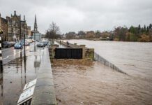
A new study appears to reveal the potential cost to property from the ‘hidden hazard’ of groundwater flooding in England, and points to inadequacies with the perspective favoured by the current regulatory structure for managing groundwater.
Environmental consultancy ESI has completed national mapping and developed preliminary economic analysis on the risk of groundwater flooding to property and infrastructure. This, combined with other flood risks has now created the first “Flooding from All Sources” dataset using advanced modelling techniques on a 5m grid.
Drawing on available Environment Agency, Ordnance Survey, and British Geological Survey data and the GeoSmart national groundwater flood risk maps, ESI is discussing with Defra how these ‘flood risk from all sources’ maps may be made available for public use.
In launching the mapping and risk analysis, ESI is advocating an immediate increase in the Environment Agency’s flood risk management function, with more focus on groundwater science on a catchment basis.
ESI believes that flood risk analysis and recommendations from recent government reviews have, to date, been too “rivers-centric” and a more robust risk management plan is needed. This must be developed to understand and tackle a costly, but largely ignored natural hazard.
ESI Director Mark Fermor says:
“Groundwater is poorly understood. We know to our cost that the general public, businesses and authorities cannot foresee what is going on beneath our feet. Our national modelling has revealed the scale of the problem but also highlights very large uncertainties, partly due to lack of catchment-based focus and the role of groundwater.”
“Our regulatory structure is not looking at the issues from a catchment flow perspective. Groundwater is classed as ‘Local Flooding’ and part of ‘Surface Water Flooding’, assigning risk management to local authorities within administrative rather than catchment boundaries”
“This is a serious barrier to a clear and objective understanding of the risk. Most of the water in our southern English rivers is derived from groundwater, so it is obvious that a catchment approach is essential.”
“Local Authority boundaries and river catchments do not match up, “continued Fermor, “so it is unfair to expect a Council or Unitary Authority to be able to assess flood risk effectively.
“We should empower the Environment Agency, our catchment specialists, to take on this role, and provide updated risk management plans as a matter of urgency before we are faced with another difficult winter. Without detailed groundwater flood risk mapping at present, they cannot make vital strategic planning decisions.”
Many insurance policies exclude groundwater. ESI believes that clearer recognition of the risk to property and the role that groundwater plays in driving catchment flood risk will help the householder and hence the insurance industry wake up to the need for appropriate cover.
Concluded Mark Fermor:
“Homeowners and businesses remain vulnerable and face potentially £500m+ worth of economic loss to property every year, according to our preliminary analysis. Infrastructure impact and consequential losses add to this. Groundwater flood risk maps are now available, which for the first time enable a joined up approach to understanding threats to property and infrastructure from flooding from all sources.”
The detailed 5m Groundwater national map is available under licence from ESI’s sister company, GeoSmart Information here.
A Technical Summary on the preliminary economic impact of groundwater flood risk is now available for download here.


