

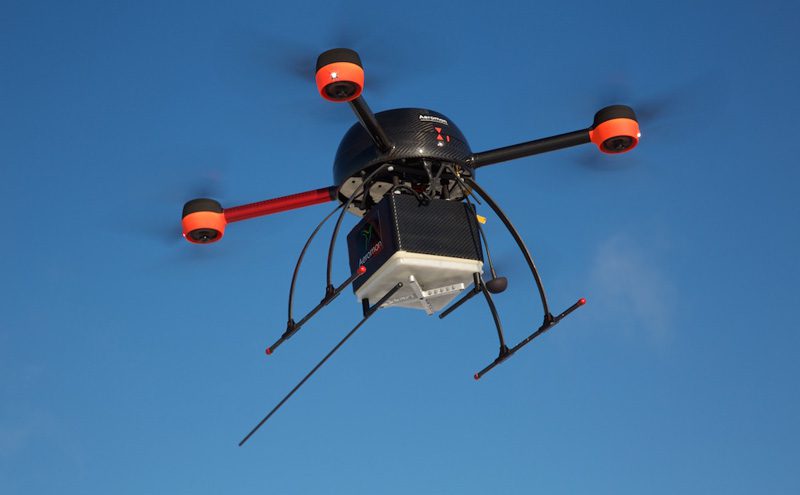
Finnish cleantech startup Aeromon has developed a seemingly unique platform for rapidly mapping over 70 different industrial emissions. By deploying sensors in static, hand-held and drone-mounted configurations, Aeromon says it uses its cloud-based service to “fluidly analyse emissions patterns in any industrial setting” – including those that previously proved difficult to access. In this way, says the firm, its clients can make important savings in time and resources in the effort to manage the environmental effects of their operations, and to protect members of the public from potential unforeseen hazards.
The company was founded in 2015 with the original intent to monitor shipping emissions in harbours. However, Jouko Salo, Aeromon Chairman, says he soon realized the platform had the potential to help a wide range of clients. “I saw that there were no technologies available to monitor emissions from ships sailing on the seas near coastlines. We made the decision to apply [a] flexible modular architecture to our design from the very beginning so that we could vary the systems for multiple uses. This has proven valuable in building the monitoring concept for environmental emissions and [the] process industry.”
Aeromon seemingly conducted successful pilots at the Ämmässuo waste treatment centre (operated by the Helsinki Region Environmental Services Authority) in 2015, and at oil and gas industry sites in 2016. The pilot studies apparently demonstrated the potential to make significant efficiency and financial savings in process industry monitoring applications.
In each study, the lightweight, easily deployable nature of the Aeromon platform made it possible to map large areas which would normally prove time-consuming solely on foot. When coupled with automated analysis and visual reporting, the whole emissions mapping process gains huge efficiency increases.
“By measuring emissions with drones, we now have the potential to locate emissions which might otherwise go unnoticed,” concludes Jouko Salo. “It also allows our clients to get more complete results quicker than ever before, as difficult locations can now be easily reached and mapping can be done swiftly. Also, our cloud-based automatic reporting and calibration management makes the workflow leaner, which in turn gives companies more time to focus on actions based on their newly-acquired information.”


