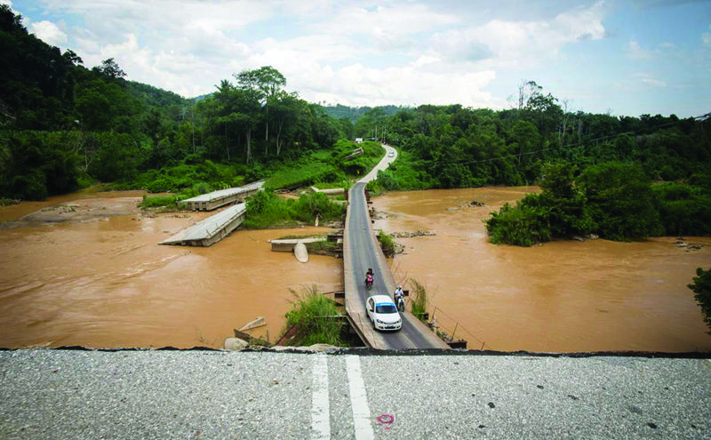
HR Wallingford, a consulancy working in civil engineering and environmental hydraulics, discusses its recent work on flood forecasting and warning systems in Malaysia
Across Malaysia, an estimated fifth of the population is at risk from flooding. Large areas of the country repeatedly suffer from prolonged and significant floods which cause widespread disruption for communities, business and critical infrastructure, often requiring many tens of thousands of people to be evacuated from affected areas. Rapid urban growth has also had an impact over the past decade, modifying rivers’ flow regimes and flooding mechanisms.
The Malaysian government’s Department of Irrigation and Drainage (DID) provides a flood forecasting and warning service to the public. HR Wallingford is working with DID to develop a programme based on the phased implementation of systems, which together form a new National Flood Forecasting and Warning System (NaFFWS) for its key river basins.

The objective of the new National Flood Forecasting and Warning System (NaFFWS) is to develop and maintain an effective and efficient integrated flood forecasting and river monitoring system (iFFRM), with flood warning dissemination, using national network data, telemetry data, radar data and rainfall forecasts. This iFFRM tool is designed to enable effective decision support by DID. Ultimately, the NaFFWS will represent all of the key river basins, however, systems for each of the rivers are being implemented in groups.
HR Wallingford developed the first system for Sungai Muar, on the west coast of Malaysia, which became operational in 2014. Since then, a system for Sungai Kedah, on the west coast, has been implemented and three east coast rivers (Sg Kelantan, Sg Terengganu and Sg Pahang) have been started, all with support from HR Wallingford’s UK and Malaysian-based experts. HR Wallingford’s extensive experience in developing similar systems for tropical river basins has been critical to the success of these projects, where data availability can be challenging and lead times for flood warning can be short.
The components of the NaFFWS are fully automated systems driven by a combination of live, telemetered gauged data from DID’s own InfoBanjir database, spatial rainfall radar data, and numerical weather prediction rainfall forecasts from the Malaysian Meteorological Department. Typically, automatic hourly simulations are carried out to forecast water levels and flows in the river channels, and to map the flood inundation process within the flood plains.
The results are used to inform and warn DID staff, so that they can take immediate action to provide an effective and proactive emergency response. Results are also passed to DID web pages, and to dedicated smartphone applications, enabling forecasts to be disseminated more widely. A parallel analytical modelling network can take over the forecasting role should the primary systems fail.
Ongoing structural measures for flood mitigation are captured through a flexible modelling approach that can incorporate model updates to reflect real changes in the catchments, complementing the structural measures being implemented by DID and ensuring a sustainable flood warning solution with long term benefits.


