

Ordnance Survey is working with consultancy firm CGI to investigate the possibilities of using Earth observation data to detect sewage from space. Launched by CGI and the UNFCCC, the Sustainability Exploration Environmental Data Science (SEEDS) programme is described as “an exciting research initiative to challenge the thinking and practice around sustainability, provide predictive analysis and viable solutions to tackle this critical issue.”
As part of the SEEDS programme, CGI and OS has conducted preliminary research to see if Earth observation could be a potential solution for the problem of sewage spill detection. More than half of key climate data comes from space and combined with geospatial data, Earth observation has the potential to devise a more robust monitoring system for sewage outspills and downstream impact.
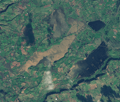
As part of the research programme, the Earth imaging satellite company Planet, provided detailed satellite imagery in which each pixel translates to 3.7 m2 on the ground. The initial findings show that Planet data has the potential to identify organic matter in waterways and could be used to detect organic matter from sewage overspills and their downstream impact. This type of data could be a valuable input into an early warning system for water bodies across the UK.
Predictive analysis is vital in order to monitor and mitigate risk, because if we are able to better determine the likelihood that sewage will be dumped at a specific location or where there will be an overspill, water companies will be able to make preparations in advance to mitigate the impact of the release.
OS says its data scientists have the expertise to predict areas at greater risk. Using OS location data, they can identify different land cover types, terrain, height, and densely populated areas, building cover and predict where there is likely to be a sewage outflow after increased rainfall. This is because urban areas are more likely to have overspills due to paved or concrete areas absorbing less water than undeveloped nature and this creates run off water that impacts on the sewage system.
Equally it’s important to combine data sources, such as using historical records from the UK’s Met Office, to create a dataset showing how much rain was released over each outflow site. Combined with location data you can more accurately predict how much rainfall would be absorbed by the land and where viable solutions can be put into effect.
As part of the research programme, the data collected was inputted to create over 90 AI models that aimed to foresee when overspill events would occur. The best of these models was able to correctly predict an event 91.5% of the time. This just highlights how technology and AI can benefit government, local authorities, and water companies to help identify where improvements need to be made to surface water drainage, where to increase storage capacity and find ways to divert rain back to the environment naturally.
OS says it is using AI to identify where funding can be applied to improve access to proper sanitary facilities like toilets and clean drinking water in developing countries. Using aerial imagery OS generated a new base map of Lusaka, Zambia using AI to identify informal settlements which are often polluted and with inadequate housing. The project was to enable better targeting of investment in critical infrastructure and services such as sanitation facilities and clean drinking water to create a healthier environment.
If we are to solve some of the world’s most pressing climate and sustainability problems, there needs to be greater collaboration that utilises the best geospatial and Earth observation analytics. By sharing data and expertise we will produce more consistent, accurate, and useful data that can improve predictive analysis and improve confidence in AI modelling and ensure we can robustly monitor our waterways for signs of sewage and then implement the right solutions.
Donna Lyndsay, Strategic Market Lead, Sustainability, OS said; “It has been said that only 14% of UK rivers meet good environmental standards. Although we are conducting this research project over the UK, we would like to have the possibility of expanding the project internationally. The increasing availability of accurate and faster data sources, such as Earth observation and location data, combined with the expertise of our data scientists and research and innovation team, unlocks the potential for predictive analysis and demonstrates the value of geospatial data in solving some of the world’s biggest challenges.”
Mattie Yeta, Chief Sustainability Officer, CGI said; “I am delighted that the UN and CGI launched the SEEDS programme last year. Since launching the programme, we have progressed with ten projects, including our water pollution monitoring using satellites. In addition, we have also worked with Ordnance Survey and Planet to demonstrate the role satellites play in climate action, including adaptation, resilience, and human wellbeing. Looking forward to progressing our efforts even further.”
For more information visit Environmental Sustainability | Ordnance Survey


