

Satellite data and AI technology can perform essential ecological surveys to guide reporting and nature recovery strategies, says Software as a service (SaaS) AI firm AiDash
From November 2023, local planning authorities (LPAs) in England must begin receiving, assessing, and reviewing planning applications with biodiversity baseline and biodiversity net gain (BNG) plans from project developers to ensure they meet the 10% BNG requirements enforced by the Environment Act. They must also abide by new reporting guidelines, which insist that active projects should be monitored and reported to DEFRA, by LPAs, for 30 years after initial approval, as well as create Local Nature Recovery Strategies (LNRS) to identify nature restoration opportunities in their designated areas.
Ideally, LPAs would have leaned on the expertise of ecologists to establish a baseline assessment, to ensure BNG is being achieved and maintained, and to suggest strategies for local nature recovery. However, the last decade has seen the supply of qualified ecologists consistently decrease. A recent Defra survey of 337 individuals working across 192 LPAs showed that more than 90% reported that their current expertise and ecological resources would be inadequate to deliver BNG. As part of that, only 5% believe they have the requisite resources to scrutinise all applications that might affect biodiversity.
Failure to comply with the new legislation will result in penalties, fines, and reputational risks for LPAs and stakeholders alike. With a limited means of capturing critical baseline data, LPAs must look to emerging technologies to measure and analyse land at scale, or else breach their legal duty to report on biodiversity and deliver nature recovery strategies.
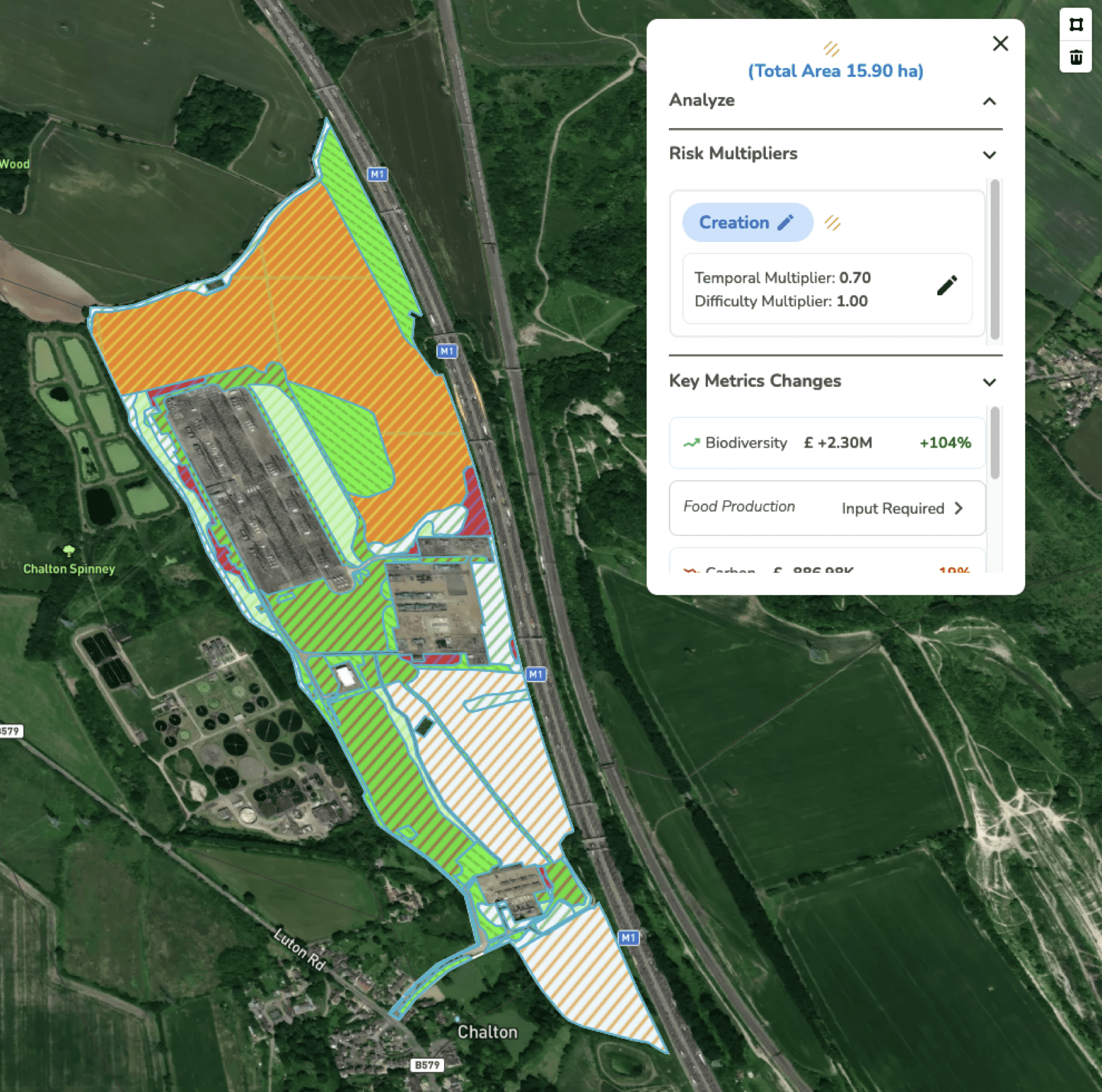
Advances in satellite technology and AI that can accurately map biodiversity and generate objective data come at a critical time for planners. AiDash’s Intelligent Sustainability Management System (ISMS) uses satellite measurements and AI-powered models to automate ecological surveys and reporting, as well as optimise future restoration strategies. By combining information from high-resolution satellite imagery with public data sources and LPA environmental data, the ISMS can provide users with more than raw data, it can also manage the BNG workflow from start to finish and reduce the effort and cost involved to meet compliance by over 75%.
Previously, measuring biodiversity and crafting recovery plans by deploying ecologists on site has been a time-consuming, expensive, and incomplete practice prone to unconscious bias. Ecologist-approved technology like ISMS can strip away human error and subjectivity to apply an accurate surveying method that LPAs can rely upon for the proper regulation of BNG in land applications. In contrast to legacy BNG methods, these new systems can secure comprehensive biodiversity data at a fraction of the cost, over large or multiple sites, and in a matter of days, which is a consideration LPAs will want to weigh up when they devise 30-year progress-checking schedules.
“The industry must move beyond just manual processes to achieve biodiversity net gain objectives,” says Shashin Mishra, Vice President of EMEA at AiDash. “Local authorities are now legally mandated to identify opportunities for securing measurable net gain and auditing compliance. However, a shortage of ecologists and inefficient surveying methods conspire to threaten the ability of LPAs to meet their BNG obligations.
“Under tight timelines for compliance, we believe there is a real opportunity for systems that use AI and satellite surveying technologies to make significant headway in assisting LPAs to plan for LNRS, assess BNG conditions in planning applications, and report on their progress as part of their wider BNG strategies.”


