This article contains paid-for content created in collaboration with OTT Hydrometry Ltd
2020 was an unusual year in many respects, but for OTT Hydromet, one of the more remarkable features of the year was an unprecedented level of orders for water level and flow monitoring equipment. Amid increasing pressure from climate change and urbanisation, OTT’s UK Managing Director Nigel Grimsley explains the growing demand for monitoring technology that enables more effective water management.
Looking back
In 1978 OTT launched the Allgomatic – a large desktop device for ‘data measurement, storage and transmission,’ – it wasn’t even called a datalogger. Prior to the Internet and mobile phones, OTT’s customers were monitoring water level in boreholes and stilling wells with dip tapes or sensors such as shaft encoders and compressed air bubblers connected to displays, dataloggers or chart recorders. Discharge calculations were based on stage measurements, possibly with a point and hook gauge, combined with manual measurements of velocity with a rotating element current meter. Raingauges were mostly operating with a collection vessel or with a tipping bucket mechanism; recording tips with a connected datalogger. Inevitably, this provided a retrospective view of water resources that was mainly useful for detecting trends and informing models.
Flood protection measures at this time were often designed to increase channel capacity and/or divert water away from sensitive areas. This may have involved engineered flood defence infrastructure with higher flood defences and straighter channels. Flood plains were increasingly used for agricultural, commercial or residential development, and the creation of ever-growing areas of impervious concrete and asphalt increased flood risk at a time when climate change was starting to increase the frequency and severity of severe weather.
Looking forward
Jump forward to today and flood management has changed dramatically – Natural Flood Management (NFM) is now regarded as a more effective and sustainable strategy. Flood risk is now addressed on a wider catchment scale so that upstream initiatives do not have negative effects further downstream. This catchment based approach has meant that
water managers are increasingly looking for solutions that employ techniques which work with natural hydrological and morphological processes and features to manage flood waters. These NFM techniques include the restoration, enhancement and alteration of natural features such as flood plains. However, there are many other ways in which NFM can help to lower peak flow and decrease flood risk. Tree planting for example, intercepts rainfall and overland flow, increases water infiltration into soil, and provides important connective habitat for wildlife, as well as providing increased carbon storage.
Tomorrow’s technology
In addition to the provision of baseline data, monitoring systems are also necessary for measuring the effectiveness of mitigation measures and providing timely warnings when alarm conditions arise. In order to better understand catchments, groundwater and surface water levels should be correlated with upper catchment monitoring which includes the measurement of meteorological parameters.
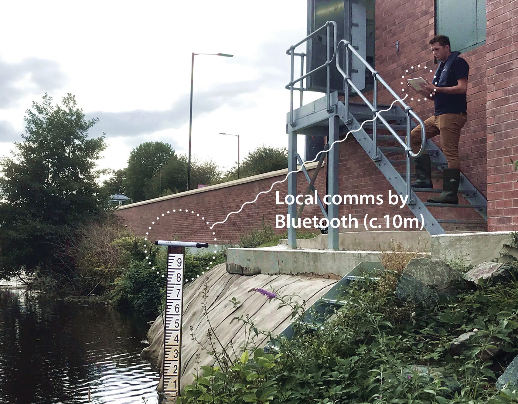
The demand for high intensity monitoring is growing rapidly, as water managers demand lower levels of uncertainty in their monitoring data, and seek to exploit the advantages of networks of continuous monitors. The high volumes of orders that OTT received in 2020 featured many networkable sensors such as the OTT ecoLog 1000; a self-contained surface and groundwater level logger with two-way communication for smart phones and tablets. Remote sensors were also highly popular, including the OTT SVR 100 surface water velocity radar and the OTT RLS non-contact radar level sensor. The volume of dataloggers with satellite communications capability is also increasing as network managers seeks to exploit the benefits of reduced data transmission costs.
The demand for better monitoring is driving the development of OTT’s latest hydrometeorological technologies, which can be summarised in four categories:
1. Accurate, reliable, low-power, smart sensors
2. Flexible, intelligent, easy-to-use dataloggers
3. Reliable, appropriate, cost-effective telemetry with multiple transmission options and redundancy capability
4. Customisable, easy-to-use, insightful, web-enabled, data management software
With the benefit of insights from comprehensive real-time monitoring networks, collecting high intensity data from multiple points, water managers will be able to make better informed, defensible decisions.


