

This article contains paid for content produced in collaboration with Geolux.
Hydrology monitoring expert Geolux has provided technology being used to monitor the flow of mountain rivers in Rwanda – frequently a source of flooding that has in recent years devastated the region.
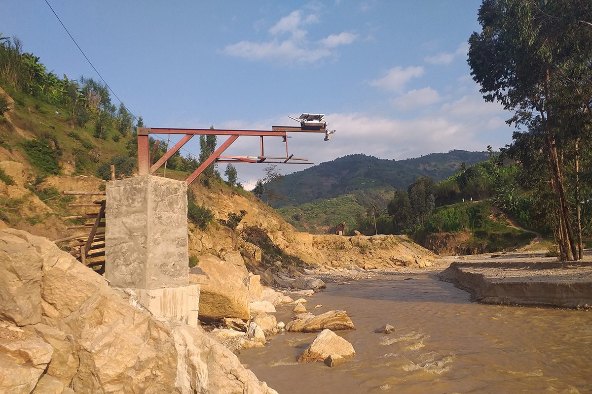
Analyzing the flow of mountain rivers is very challenging and complex. Given the role of water supply in the global environmental cycle, it is crucial to monitor how different climate change factors impact the flow of mountain rivers if floods or droughts are to be prevented from happening.
Rwanda has been flooded in the past due to its fragile soils and deforestation. Many people left the area as it was overwhelmed by river floods whose effects were all the more disastrous for the lack of natural forest protection that would normally slow down the speed of water. The International Union for Conservation of Nature reports that most of the flooding in Rwanda comes from the Sebeya, Rugezi and Giciye rivers.
To prevent potential threats that could lead to floods and destroying the agricultural land, Rwanda Mountain Tea has partnered with Geolux to implement a surface velocity and river flow monitoring network based on Geolux radar technology to track and analyze hydrological parameters. Due to the lack of previous environmental technology monitoring solutions for collecting and interpreting hydrology data in real-time, it was crucial to implement advanced solutions for river flow monitoring.
This complex situation represents a use case where Geolux has positioned itself as an expert in the most demanding hydrology situations. With many years of accumulated know-how and implemented hydrology monitoring solutions, Geolux has developed a lot of customized ground-up solutions for various terrains.


